Solution – Anti Drone
ANTI-DRONE SYSTEM
CONFIGURE THE BEST AI-BASED AUTOMATED SWARM DEFENSE SYSTEM
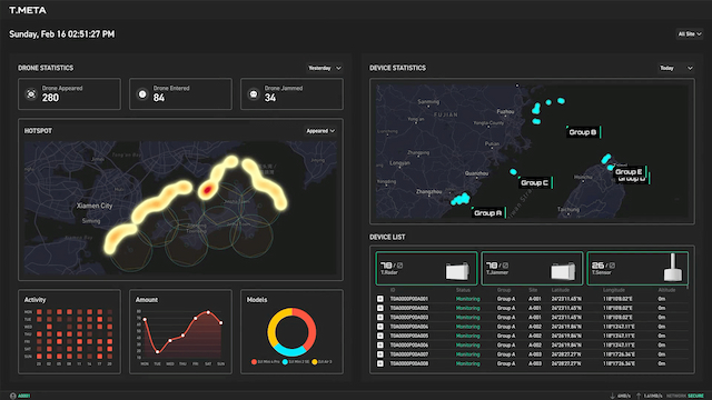
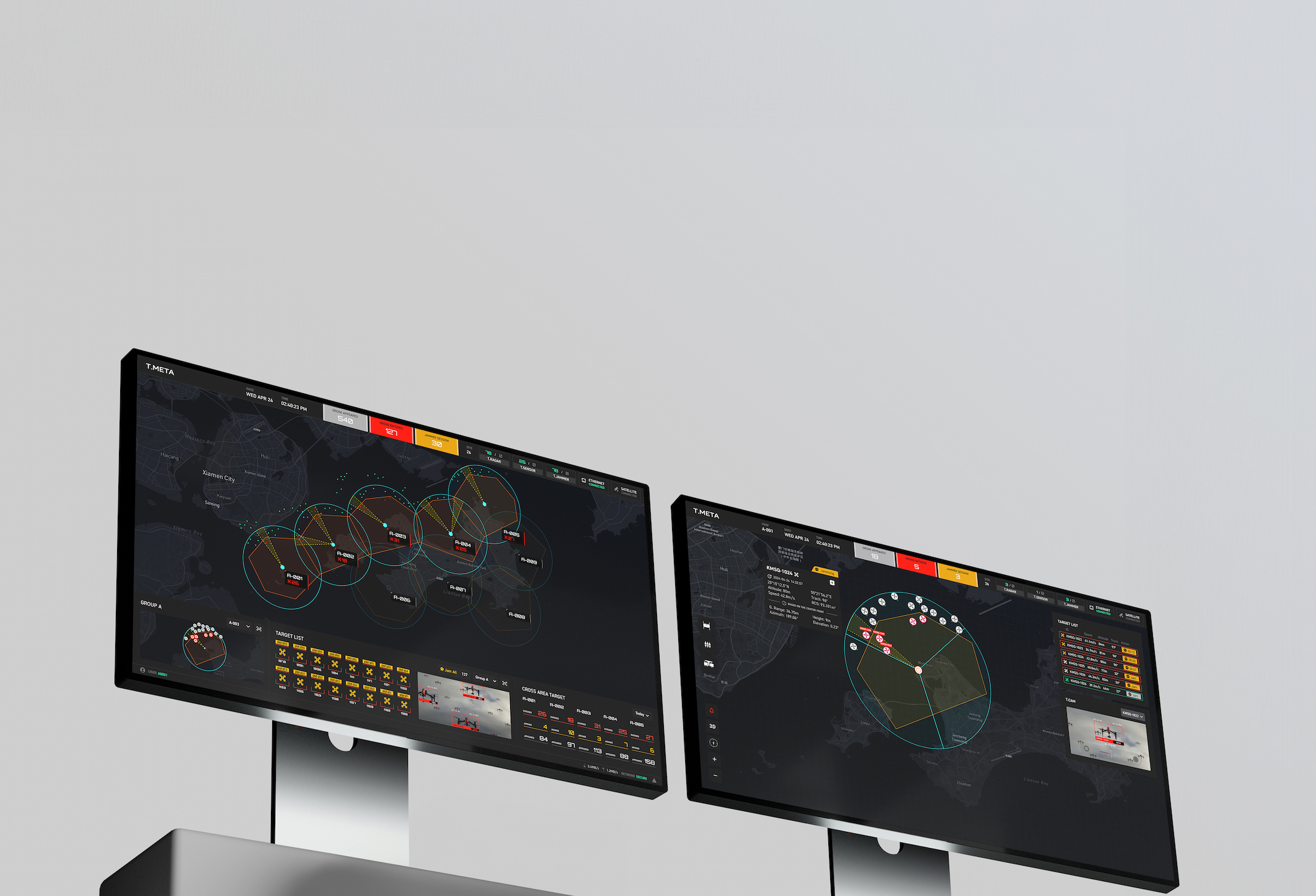
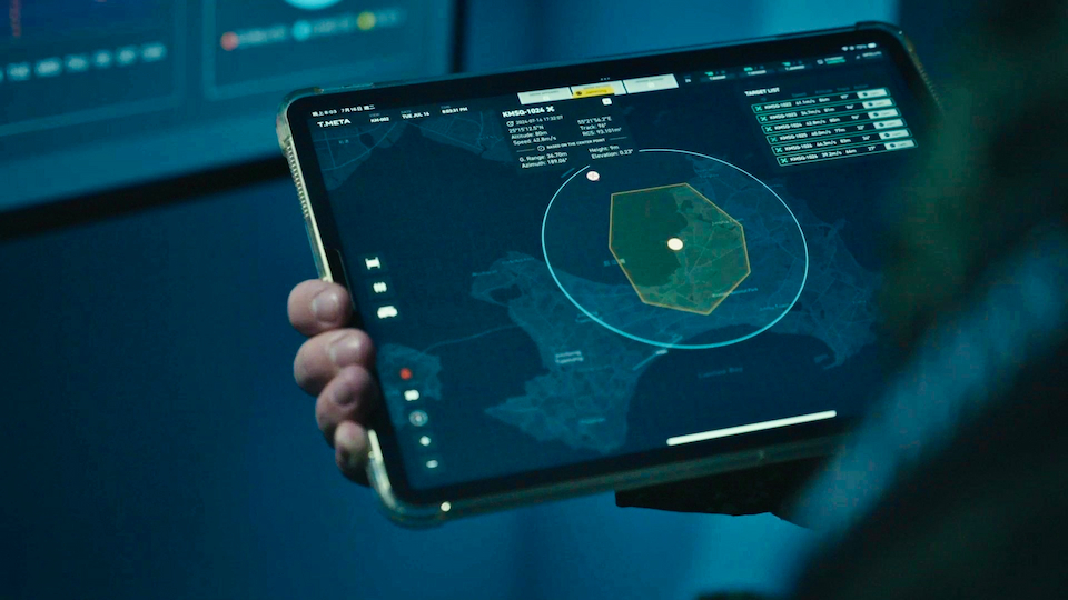
T.META
C2 SOFTWARE PLATFORM
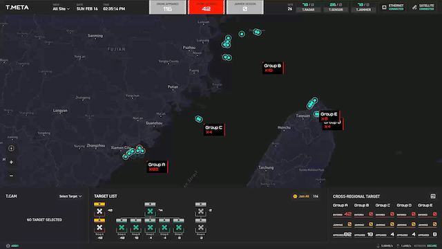
T.Meta delivers comprehensive command and control for advanced
anti-drone operations. This platform seamlessly integrates
detection systems—including T.Radar, T.Sensor, and T.Cam—with
T.Jammer and T.Interceptor countermeasures. Whether deployed
through local T.Meta Edge servers or accessed via T.Meta Cloud,
operators gain real-time control across multiple sites. The
platform features high-precision satellite mapping and immersive
3D drone tracking, while granular permission controls enable
sophisticated tactical responses through role-based access
management.
FEATURE 1
FEATURE 2
FEATURE 3
FEATURE 4
FEATURE 5
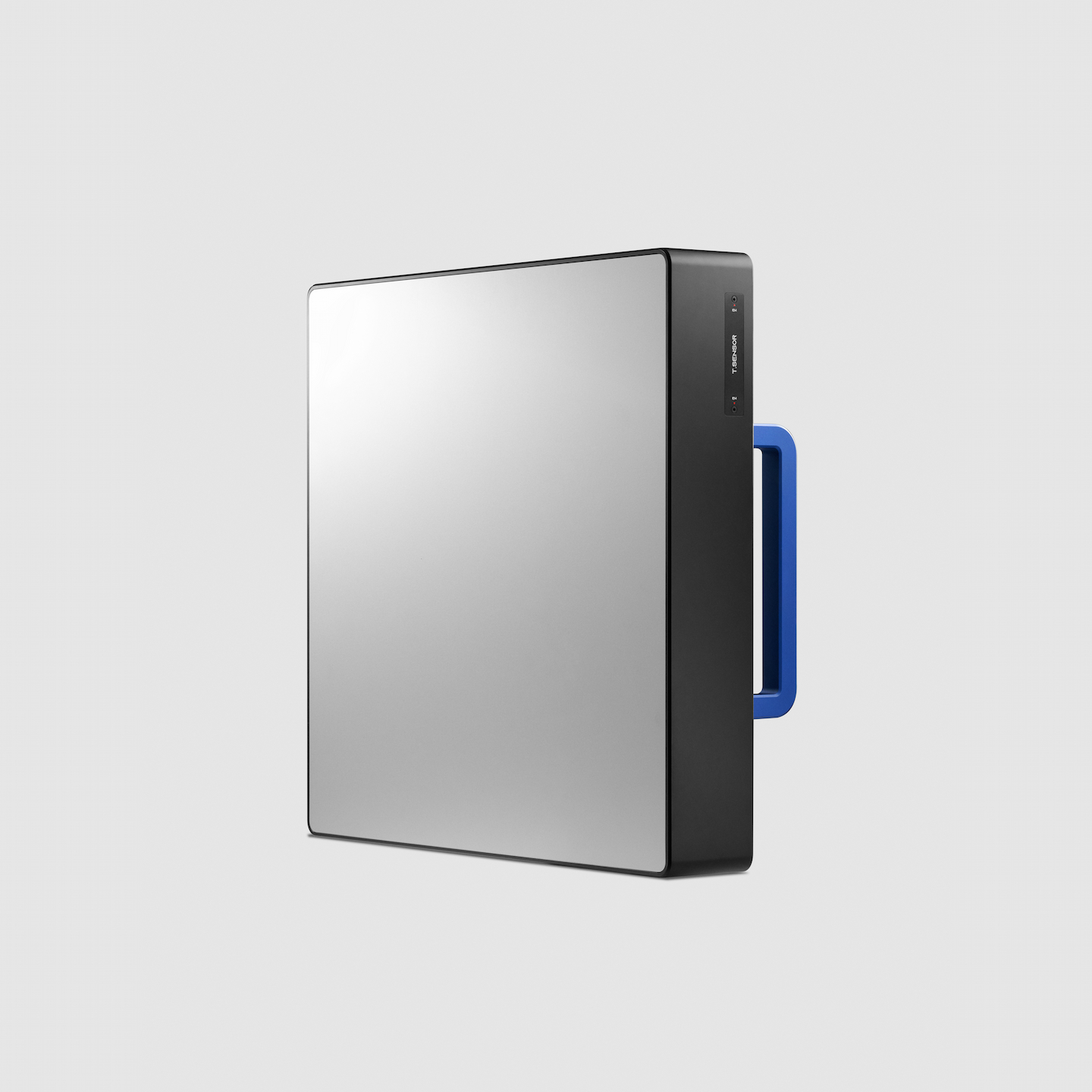

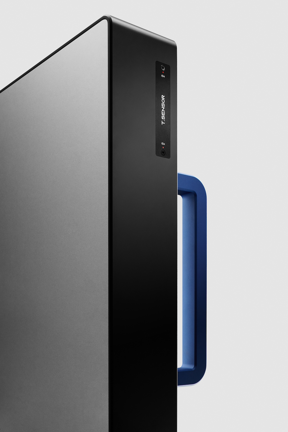
T.SENSOR
PASSIVE RF DETECTOR
T.Sensor™ is a wideband RF detector featuring advanced RemoteID
decoding and precision direction-finding capabilities. T.Sensor™
performs the following:
01 Detects pre-flight remote control signals, identifying drone manufacturers and models while locating operators for comprehensive threat intelligence.
02 Provides wideband RF coverage (400 MHz - 6 GHZ) encompassing control signals, data links, and GNSS frequencies. Achieves 5 km detection range for commercial drones with 360° spatial coverage.
03 Employs triangulation across multiple CUAS sites using networked T.Sensor™s for precise drone position fixing.
When integrated with AESA T.Jammer™, T.Sensor™ enables precision reactive counter- measures, delivering autonomous defense against AI drone swarms.
Detection Range
5KM
Azimuth Coverage
360°
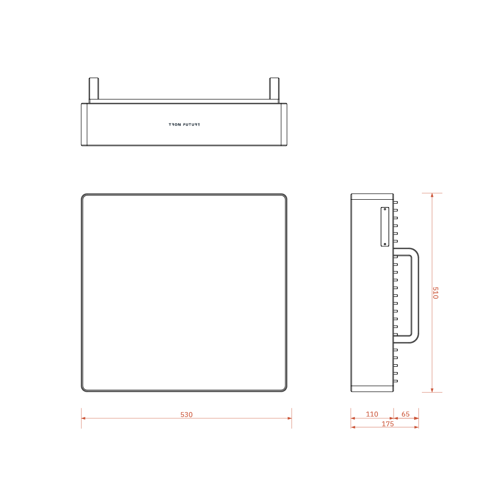
Specifications
Dimensions
Detection Module: 615 mm (diameter) x 400 mm (height)
Antenna: 120 mm (diameter) x 600 mm (height)
Antenna: 120 mm (diameter) x 600 mm (height)
Ingress Protection (IP)
IP66
Weight
39 kg
Frequency Coverage
400 MHz - 6 GHZ (including: 433 MHz, 0.8-1.7 GHZ, 2.4-2.483
GHZ, 5.2-5.9 GHz selectable / schedulable)
Azimuth Coverage
360°
Elevation Coverage
-45° ~ +90°
Drone Classification
AI-based classification on product part number / protocol
parsing
Remote ID
Support WiFi / BT for broadcasting RID ASTM F3411 DJI
OcuSync DroneID protocol
Maximum Targets
60
DF Accuracy
+/- 2.5°
Remote ID Decoding Positioning Accuracy
+/- 7.5 m
Detection Range
5 ~ 35 km (depending on electromagnetic environment)
Maximum Target Speed
160 km/h or 45 m/s
Update Rate
1 Hz
Power Consumption
< 100 W
DC supply
24 V / 10 A
AC Supply
100 ~240 V/10 A
Control Interface
Gigabit Ethernet
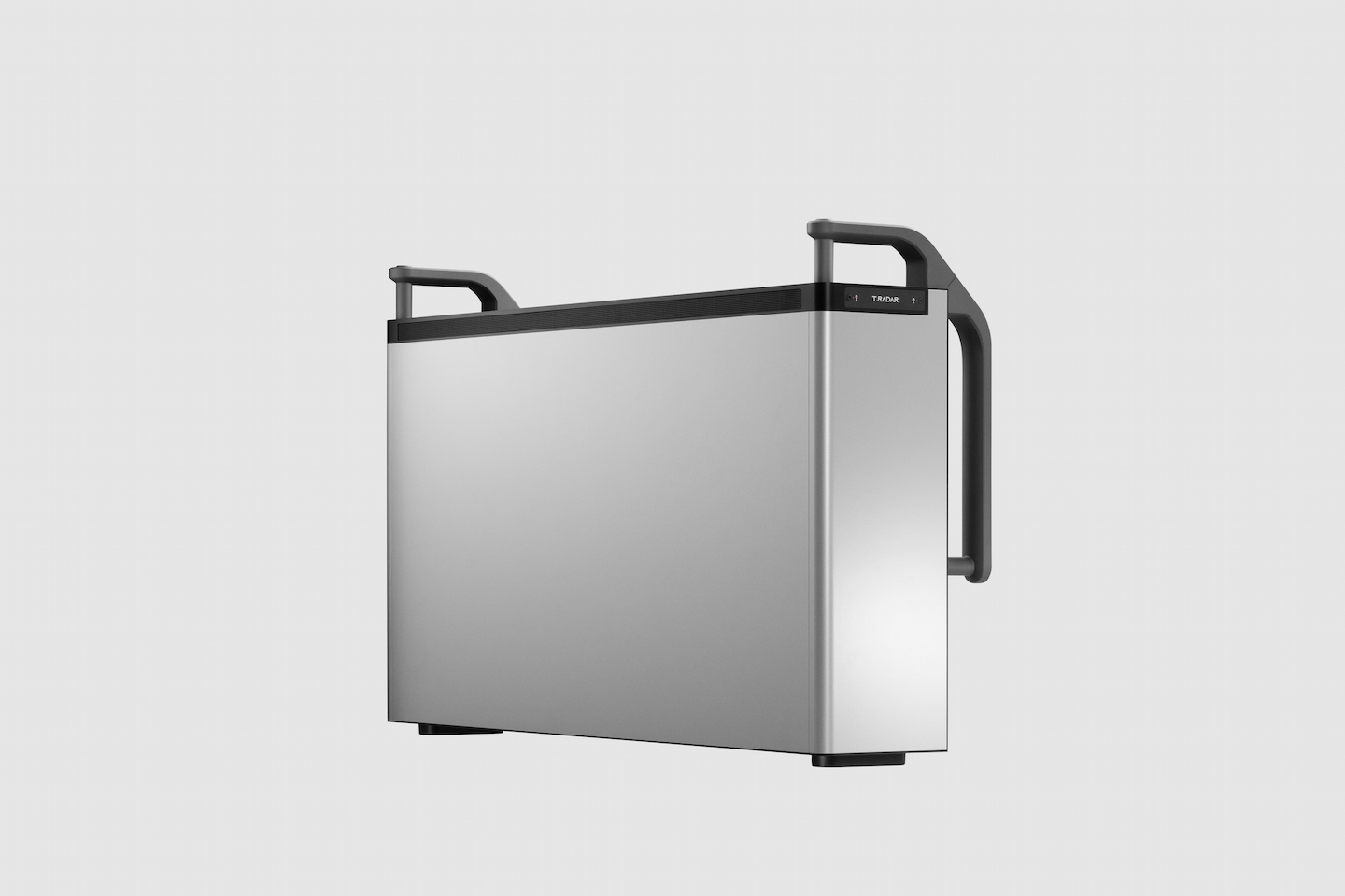

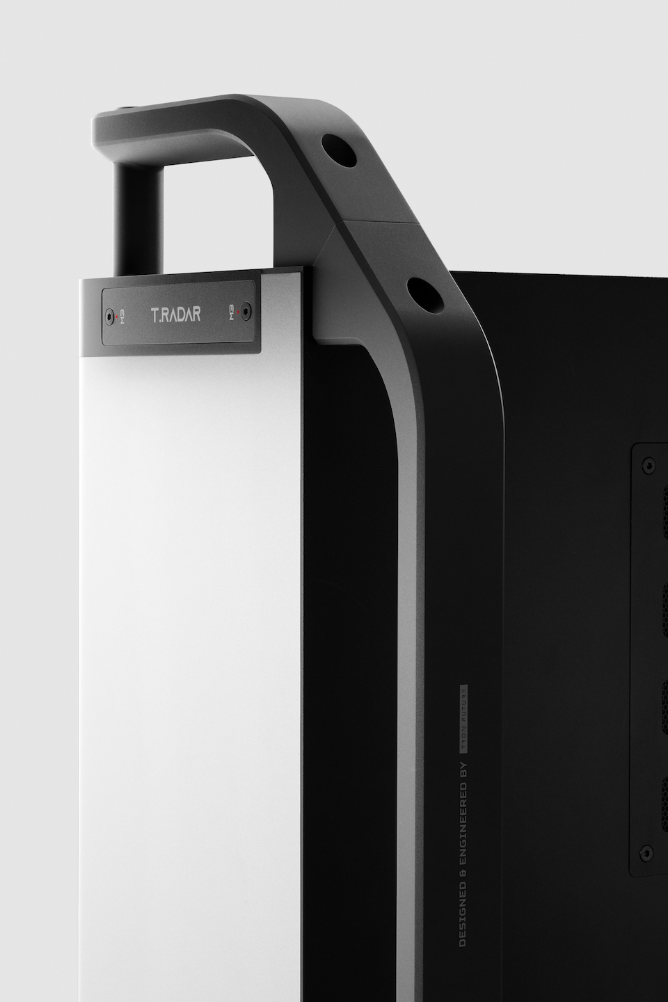
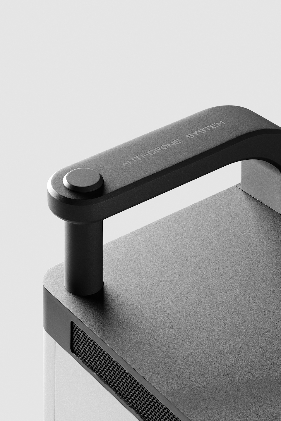
T.RADAR ER
4D AESA RADAR
T.Radar ER is an advanced software-defined 4D AESA pulse-Doppler
radar engineered to military specifications, achieving detection
ranges up to 6km for commercial drones like the DJI Mavic 3. Its
Element-Level Digital Adaptive Beamforming and GaN amplifiers
enable precise tracking of low-RCS targets (down to 0.01 m2),
while Kinematic Tracking algorithms identify multi-rotor drones
through flight pattern analysis.
Designed for fixed installations like border security and critical infrastructure protec- tion, the system features adjustable tripod mounts for optimal coverage across varied terrain. This all-digital system delivers reliable long-range surveillance capability for sustained operations.
Designed for fixed installations like border security and critical infrastructure protec- tion, the system features adjustable tripod mounts for optimal coverage across varied terrain. This all-digital system delivers reliable long-range surveillance capability for sustained operations.
Detection Range
6KM
Azimuth Coverage
120°
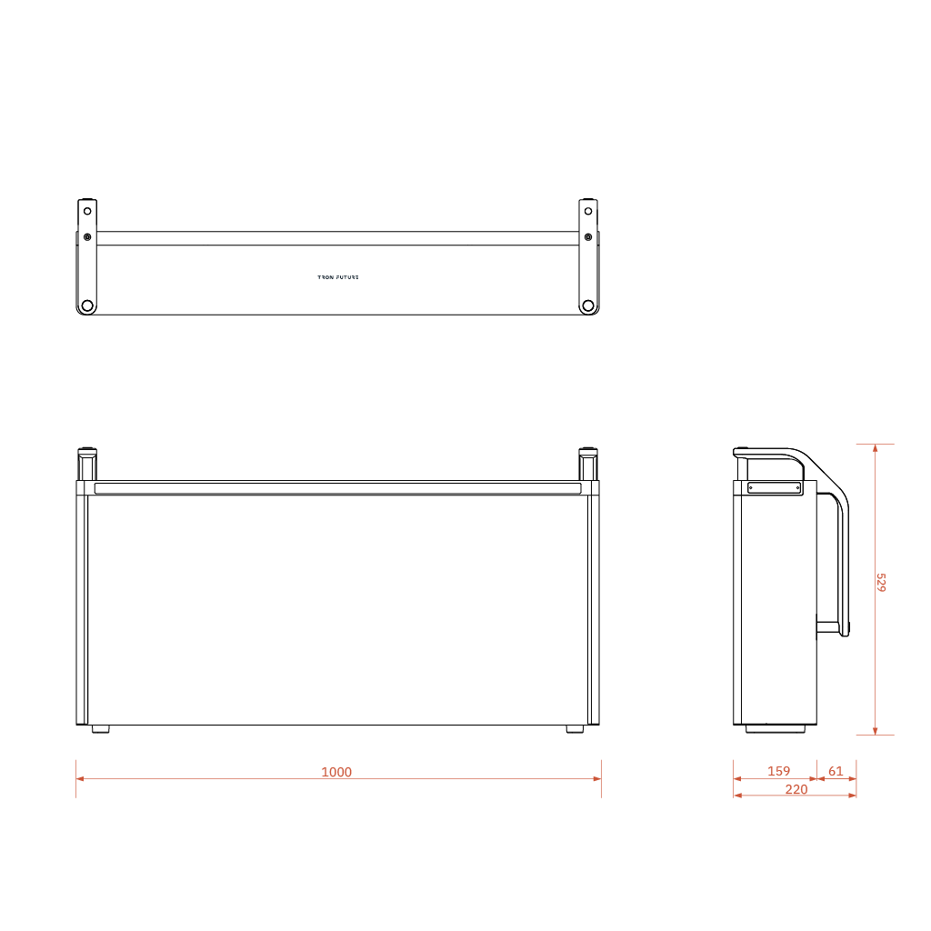
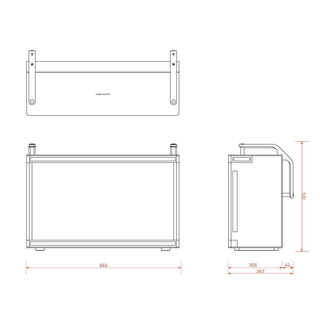
Specifications
Dimensions
100 cm x 52.9 cm x 15.9 cm (handle excluded)
100 cm x 52.9 cm x 22 cm (handle included)
100 cm x 52.9 cm x 22 cm (handle included)
Weight
38 kg
Ingress Protection (IP)
IP66
Operating Temperature
-32°C ~ +50°C
Network Interface
1 Gbps Ethernet
Power Input
AC 100 - 240 V
Array Type
Fully Digital (Element-Level) Transceiver
Operating Frequency
2.9 GHZ - 3.1 GHZ (S-band)
Polarization
Horizontally Linear
Peak Power per Transmitter
10 Watt
Peak Radiation Power
160 Watt
Max. Power Consumption
220 Watt
RF Front-end Circuit
Digital CMOS Transceiver and Digital IQ Phase Shifter
Positioning
GPS
Multi-Radar Integration
Yes
Mode
Track-While-Scan (TWS) (Default)
Threat Target Recognition
Yes (Optional)
Min. Target RCS
0.01 square meter (sm)
Max. Detection Range
6 km
Min. Detection Range
100 m
Max. Azimuth Coverage
120° (-60° ~ 60°)
Max. Elevation Coverage
75° (-15° ~ 60°)
Max. Target Speed
30 m/s, Programmable
Target Info
3D Position, 3D Velocity, and RCS
One-Round Scan Interval
1 sec, Programmable
Scanning Volume
Configurable via GUI/API
Scanning Type
Horizontally-Narrow Scanning with Vertically-Wide Fan-Beam
Range Resolution
15 m, Programmable
Velocity Resolution
1 m/s, Programmable
Transmit Beamwidth
7º
Azimuth Tracking Accuracy
< 2°
Elevation Tracking Accuracy
<5°
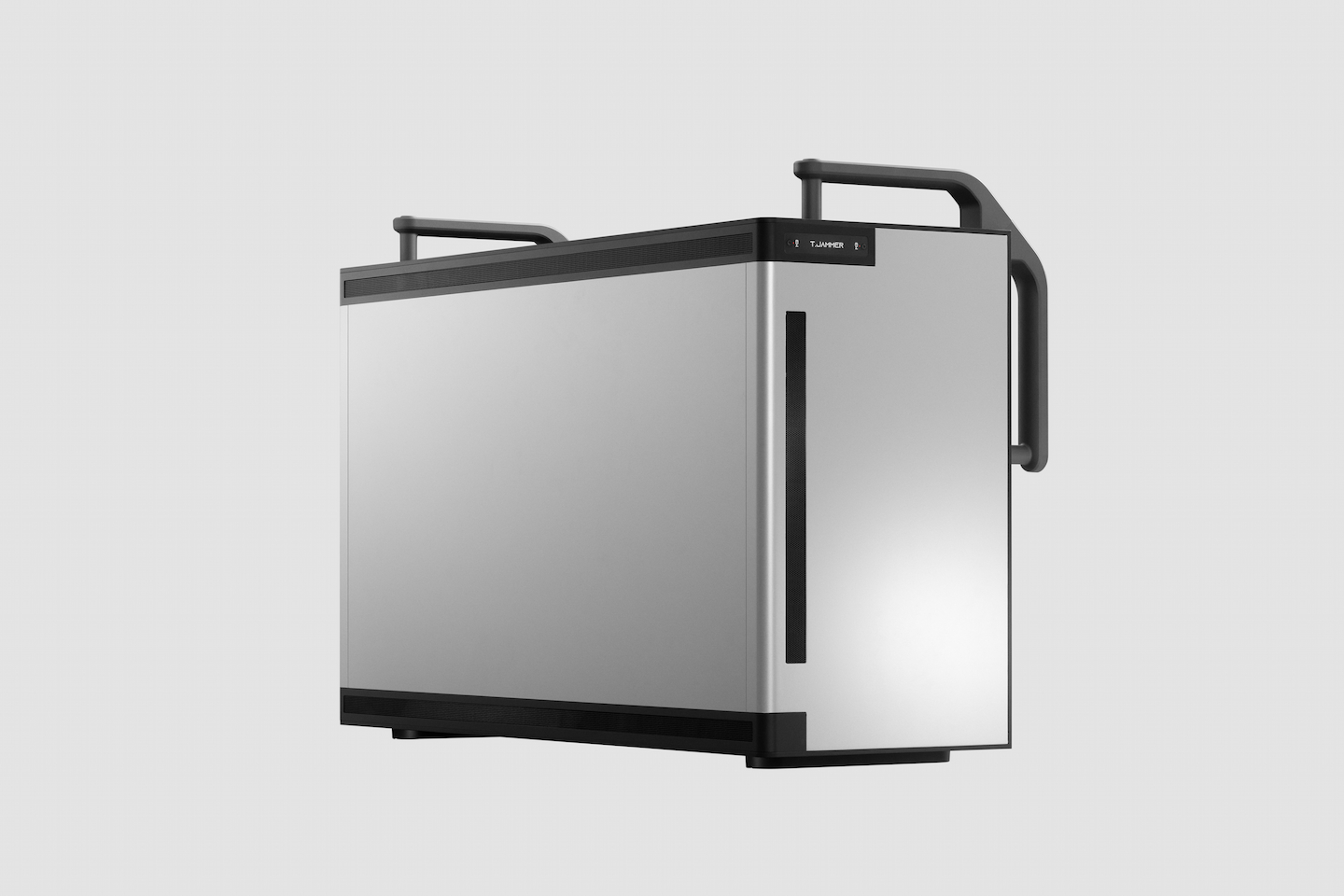

T.JAMMER
AESA SOFT-KILL COUNTERMEASURE
T.Jammer™ is a software-defined Active Electronically Scanned
Array (AESA) system with 5-band configuration for targeted
interference of drone communications from 400 MHz to 6 GHz.
T.Jammer™ performs the following:
01 Delivers high EIRP with optimized power consumption.
02 Executes simultaneous multi-band jamming across critical frequencies:
- 400 MHz - 1.4 GHz: Telemetry and Video Links
- 1.1 GHz - 1.7 GHz: Multi-GNSS (GPS, BeiDou, Galileo, GLONASS)
- 2.4 GHz / 5.2 ~ 5.8 GHz: Remote Control, Wi-Fi, Telemetry, Video Systems
03 Features rapid autonomous beam switching for multi-drone neutralization.
Integration with T.Sensor™ enables precision reactive jamming, combining angular and frequency accuracy to maximize effective range while minimizing response time.
JAMMING Range
5KM
Azimuth Coverage
120°
Specifications
Dimensions
86 cm (Width) X 52 cm (Height) X 31 cm (Depth)
Weight
55 kg
Ingress Protection (IP)
IP66
Jamming Range
GNSS > 5 km, Communication > 4 km. Depending on (1)
electromagnetic environment (2) distance between target
drone and its remote controller(RC).
Frequency Resolution
1 MHz
Bandwidth Resolution
1 MHZ
Frequency Coverage
Sub 1G: 400 ~ 1100 MHz, EIRP 42 dBm
L2: 1100 ~ 1500 MHz, EIRP 55 dBm
L1: 1500 ~ 2100 MHz, EIRP 58 dBm
S: 2100 ~ 2800 MHZ, EIRP 65 dBm
C: 5000 ~ 6000 MHz, EIRP 67 dBm
L2: 1100 ~ 1500 MHz, EIRP 55 dBm
L1: 1500 ~ 2100 MHz, EIRP 58 dBm
S: 2100 ~ 2800 MHZ, EIRP 65 dBm
C: 5000 ~ 6000 MHz, EIRP 67 dBm
Azimuth Coverage
+/- 60°
Elevation Coverage
Sub 1G: +/- 42°
L2 : +/- 36°
L1: +/- 39º
S: +/- 27°
C: +/- 15°
L2 : +/- 36°
L1: +/- 39º
S: +/- 27°
C: +/- 15°
Simultaneously Maximum Number of Multi-Frequency with
Different Beam-Direction
4
Max. Power Consumption
1600 W
Power Supply
100 - 240 VAC 50 / 60 Hz
Control Interface
10 / 100 M Ethernet
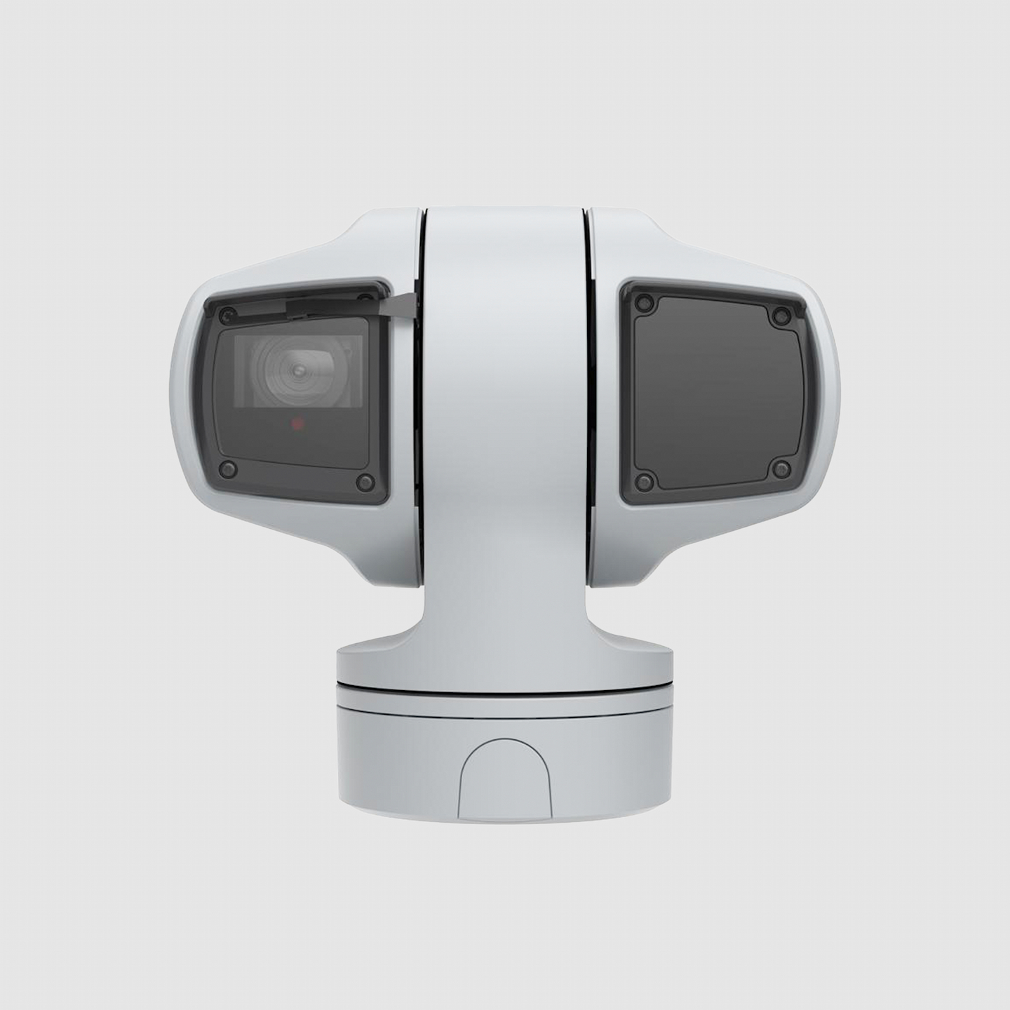
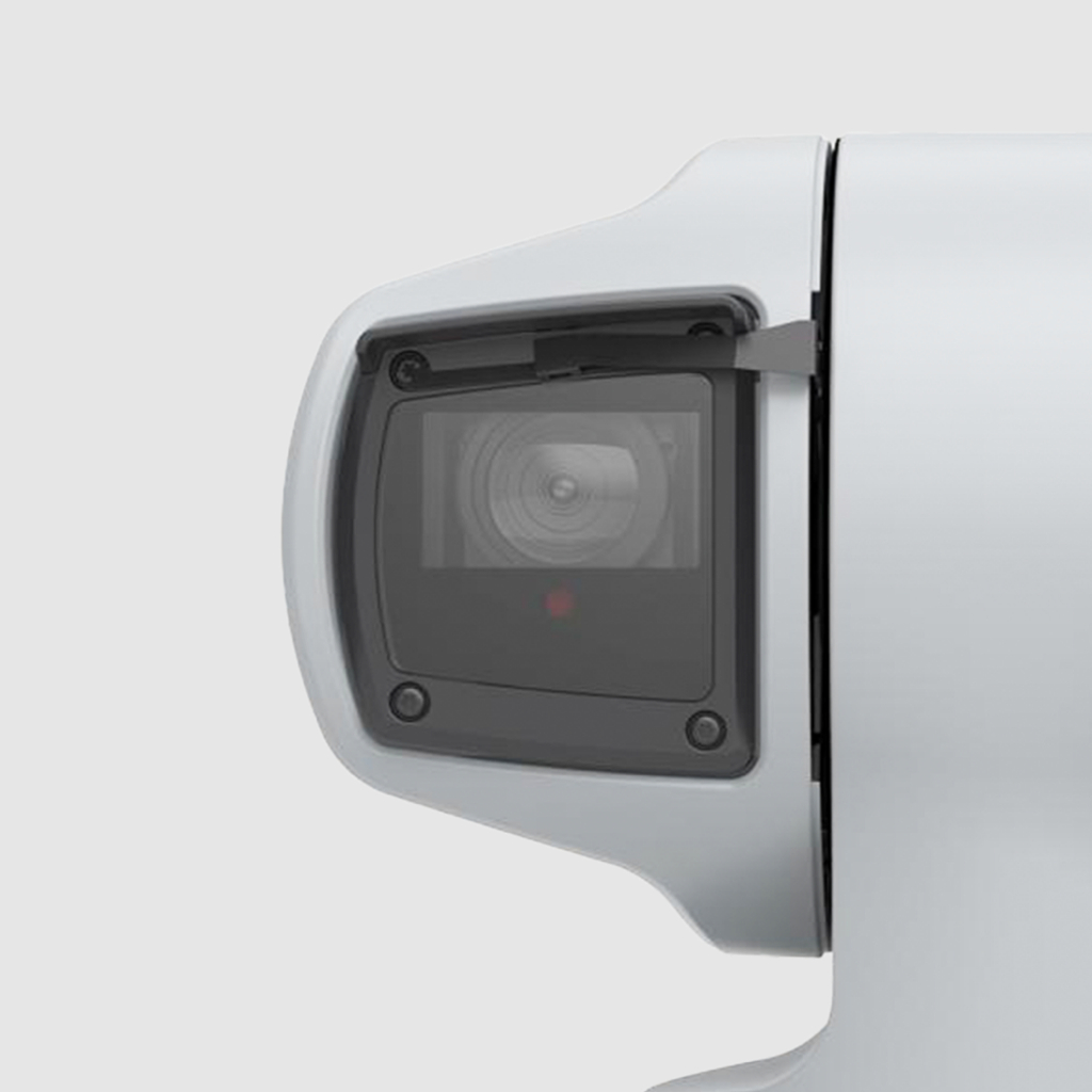
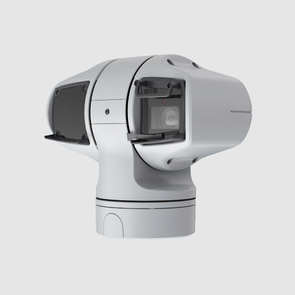
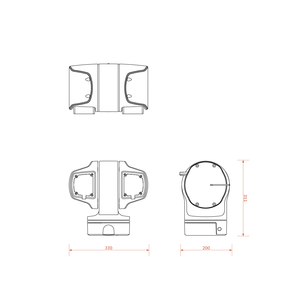
T.CAM
PTZ OPTICAL SENSOR
T.Cam™ is an AI-powered omnidirectional optical system that tracks
targets and evaluates countermeasure effectiveness. It consists of
a ground-based dual-axis gimbal camera and AI processor,
supporting threat assessment and resource allocation for drone
countermeasure operations. T.Cam™ operates in three modes:
01 Target Threat Assessment, Locking, and Tracking: Provides real-time visual tracking of airborne targets using AI-powered detection algorithms and flight telemetry data.
02 Countermeasure Verification: Confirms the success of T.Jammer™ and T.Interceptor™ countermeasures by analyzing target data and video feeds, helping operators manage resources efficiently.
03 (Upgradeable) Future AI Updates: Identifies drone manufacturers, models, and payloads to accurately assess threat levels.
Multiple T.Cam™ units can track and lock onto several targets simultaneously, enabling effective response to drone swarm attacks and providing comprehensive threat assessment and countermeasure validation.
Detection Range
1KM
Azimuth Coverage
360°
Specifications
Optical Zoom
31x
Horizontal Rotation Range
360°, continuously
Vertical Rotation Range
-90°~90°
Sensor Size
1/2-inch CMOS
Horizontal Field of View
63.8° - 2.2°
Vertical Field of View
37° - 1.3°
Ingress Protection (IP)
IP66
Detection Range
1000 meter for drones with 900 mm diagonal length
700 meter for drones with 400 mm diagonal length
700 meter for drones with 400 mm diagonal length
T.META
C2 SOFTWARE PLATFORM


ADVANCED ALGORITHM AND REAL-TIME MONITORING
Optimal tracking and scheduling algorithms enhance surveillance
quality and make the UI experience more intuitive and smooth.
Threat Analytics
T.Meta™ generates comprehensive detection reports including
drone models, flight trajectories, and temporal data, providing
operators with actionable intelligence for informed
decision-making.
ADVANCED FILTER
The filters enable users to easily screen and categorize flying
objects on the screen. Users can also specify their own
filtering conditions, such as speed, altitude, RCS, drone types,
etc., based on their preferences.
CUSTOMIZABLE SCENES AT YOUR FINGERTIPS
Easily create and manage custom surveillance areas with the
intuitive and convenient T.Meta™. Users can set up a monitoring
task by taking just a few simple steps.
Friendly Drone Management
T.Meta™'s whitelisting capability enables operators to identify
and protect authorized drones, enhancing situational awareness
and tactical precision during swarm defense operations.
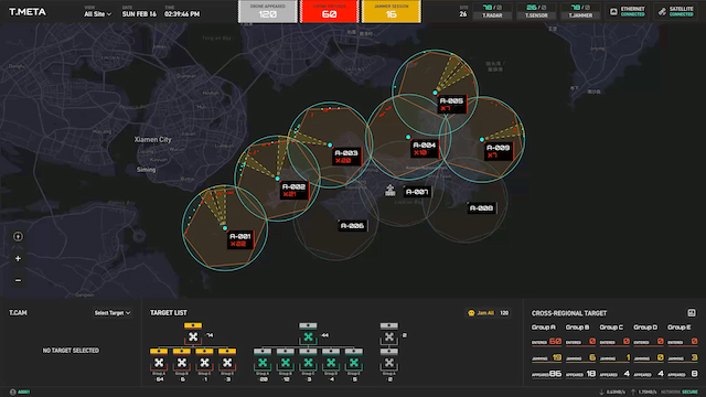
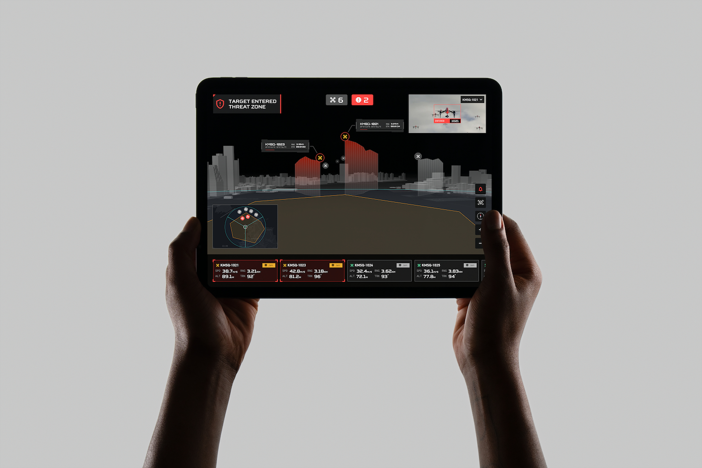
INTUITIVE OPERATION, EXTRAORDINARY EXPERIENCE
T.Meta™'s unprecedented real-time 3D visualizations are simple
yet exciting, making it easy for anyone to get started quickly.
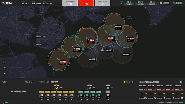
TARGET TRACKING AND THREAT ASSESSMENT
T.Meta™ is equipped with the most advanced target processing
system, enabling users to visualize and analyze flight paths
with the built-in threat assessment engine for efficient
surveillance.
SMART PLAYBACKS
The interactive playback feature recreates what had happened at
any past moment in great details. Users' surveillance behaviors,
target trajectories, threat events, etc. can be faithfully
presented.
Link copied